| Director - Imamov Airat Gaptraufovich |  | |
 | ||
APPOINTMENT AND UNIQUENESS
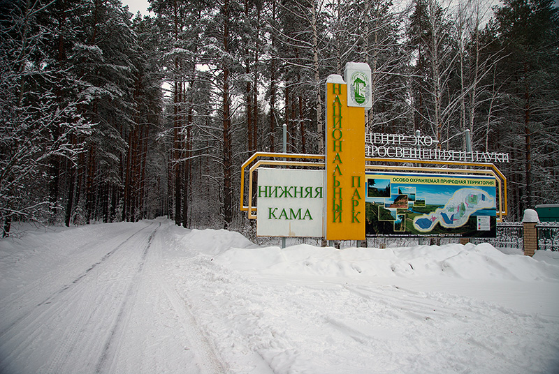 The National Park "Nizhnyaya Kama" was established in 1991 for preservation and restoration of a unique natural complex of richest floristic and typological forests and floodplain meadow associations of the Tatarstan Republic, and for their use in the scientific, recreational, educational and cultural purposes.
GEOGRAPHICAL LOCATION
The national park is situated on the north-east of the Tatarstan Republic within the East Predkamje and East Zakamje, in the valley of the Kama River and its inflows of Toima, Kriusha, Tanaika, Shilninka. Administratively territory of park is situated within the two administrative districts - Tukaevsky and Elabuzhsky. The area of national park is 26460 hectares.
CLIMATE
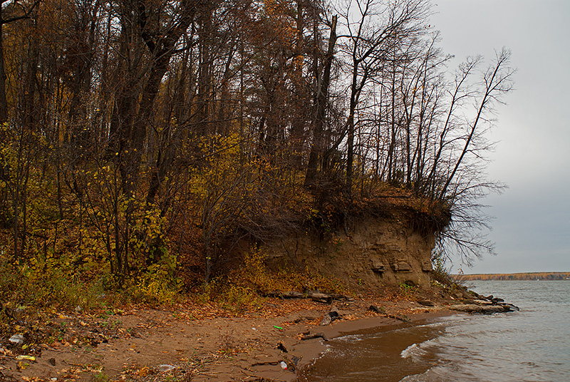 The climate is temperate-continental, with warm summers and moderately cold winters with the formation of stable snow cover. From local climatic factors it is worth noting structural features of the relief and the presence in the territory of a large body of water - Nizhnekamsk the reservoir. The climate is softened at the expense of western transfer of air masses. The warmest month is July with monthly average air temperature 19,6 degrees Celsius. The coldest month is January with an average temperature - 13.8 degrees Celsius. Period of positive average-monthly temperatures lasts from April till October; from November till March the average-monthly air temperatures negative. Average annual relative humidity - 76%. Annual precipitation - 420-480 mm. About 70% of precipitation falls during the warm season. Prevailing wind directions are westerly, south-west and southern. Average annual wind speed is 3,3-5,0 m/s. The highest wind speeds in winter. Influence of the Nizhnekamsk Reservoir is evident in the increasing wind speed above the water surface and in the coastal zone at the distance of 4-5 km.
RELIEF
The surface of the territory slightly undulating, partitioned by valleys of small rivers and creeks, gullies and ravines. The general tilting of a surface towards the valley of the Kama River. Ancient and present-day river valleys are confined to areas of tectonic depressions. Watersheds match tectonic structures, characterized by positive neotectonic movements.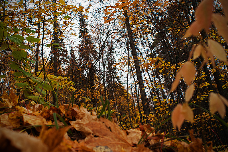 Sculptural features are combined into three genetic categories of relief: denudation, accumulative and erosive-denudation. Denudation relief is presented by the Late Pliocene surface of alignment located on absolute height 180-232 m. Accumulative relief includes into itself the alluvial plains of the left bank of the Nizhnekamsk Reservoir on the absolute elevation of 100-130 m, complicated by dunes and ridges; alluvial plains of the third and fourth floodplain terraces of the Kama River, which are respectively located at the height of 70-90 m and 90-115 m; present-day alluvial plain unites the floodplain terraces of Kama, Toima, Tanaika and Shilna with absolute height of 63-100 m. The erosion-denudation relief widely presented in territory of park, is presented by slopes and occupies absolute heights from 63 to 180 m. High right bank of the Kama River jagged by ravines. The "Tulapin Log", "Maly Erhov" and "Bolshoy Erhov" ravines are going deep into the Bolshoy Bor on 1,5-2 km. Forests of left riverbank of the Kama characterized by a minor manifestations of karst. For the forest "Bolshoy Bor" typical atmogenic forms of relief, formed 7-8 thousand years ago - parabolic dunes, longitudinal dunes, atmogenic hillocks and deflation basins. The precipitous sandy ledges of "Bolshoy Bor", in base of which there are marl layers with remains of ancient flora and fauna, with rare on the territory of Tatarstan Republic pink capitated gypsum, reaching in diameter of 60 sm, possess amazing attraction.
THE MAIN RIVERS AND LAKES
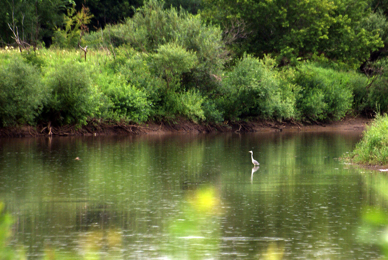
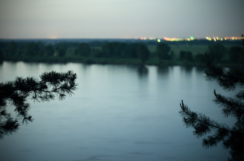 The territory of park is divided by the large Kama River, which is currently partitioned off by the hydroelectric power station's dam and has turned into a huge water pool - Nizhnekamsk Reservoir. All of the park's rivers mainly possess mixed food, presented by snowmelt, groundwater and rainwater. On the Kama River and on the small rivers are regular spring floods, which last 30-50 days. Below the dam was preserved the unique floodplain community, where is situated a lot of oxbow lakes, many of which reach a length of 1,5 km. Slightly presented in the park's territory the shallow forest lakes suffosion type, occupying the deflation basins in northern part of the Bolshoy Bor with relative depths 1,5-7,5 m.
FLORA
The park's location on the border of three climatic subzones (deciduous and fir-deciduous forests, meadow-steppes) has determined a diversity of natural landscape complexes and park's flora.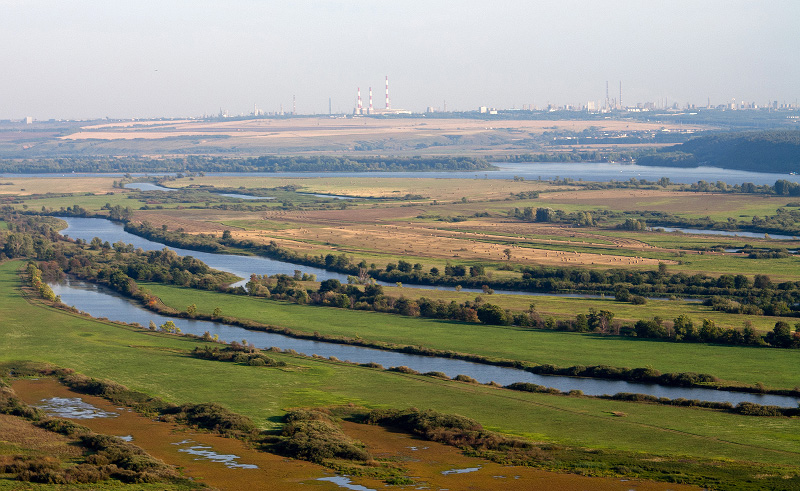 The unique Elabuga and Tanaika meadows are represented by floodplain meadows, numerous oxbow lakes, fragments of black poplar woods and well-preserved oakwood around the Boka Lake. The vegetation is represented by several associations: mixed-grass-Poa, Вromus-Sanguisorba, Carex-Poa, Bromus-Poa with Alopecurus, mixed-grass-Festuca.
 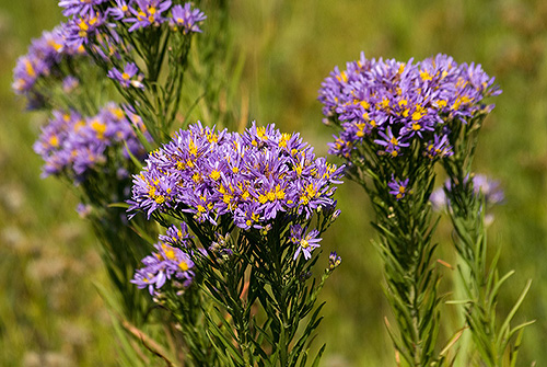 Flora of meadows represented by more than 200 plant species. Among them many are in the Red Data Book of Tatarstan Republic - Nymphaea candida (white water-lily), Nuphar luteum (yellow water-lily), Galatella rossica, Gentiana pneumononthe, Valeriana officinalis, Plantago maxima, Salvinia natans (preglacial relic), Potamogeton friesii, Selinum carvifolia, Althaea officinalis, Iris pseudacorus, Lemna gibba, Dianthus pratensis. The floodplain meadows are not withdrawn from economical activity, and therefore, they preserved traditional kinds of activity, such as haymaking, amateur fishing, ecological tourism. Forest cenosises are presented by isolated forests. The most widespread in park are pine forests (compounded with Vaccinium-Oxalis, green-moss, Calamagrostis, Pteridium), spruce-fir and pine-deciduous forests. Deciduous plantations are presented by linden, birch, aspen, black poplar and small oak-woods.
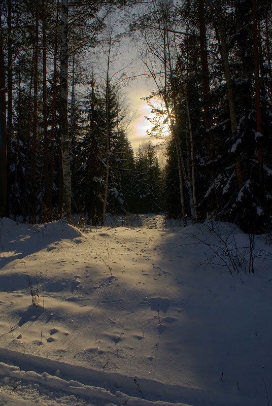
 On the left bank of the Kama River, not farther than 1,5 km from the boundary of Naberezhnye Chelny, located Beloussky the forest, a raisin of which is the tract of fir-forests the Kzyl-Tau. This is the southernmost point of the range of Abies sibirica. Here the spruce and abies form its natural plantations in the immediate vicinity with forest-steppe. A typical feature of this forest is presence in the pinery and its undergrowth of spruce, abies, oak and linden.
  The grassy cover also abounds by the boreal (Linnaea borealis, Pyrola chlorantha, Vaccinium myrtillus, Gymnocarpium dryopteris, Oxalis acetosella) and nemoral (Cacalia hastata, Cicerbita uralensis (endemic), Carex pilosa, Brachypodium sylvaticum, Anemone sylvestris, Platanthera bifolia, Mercurialis annua) plant species.
The Bolshoy Bor is located on the watershed of Kama and Toima (a right bank of the Kama River). In typological aspect it remains the richest large forest of the Tatarstan Republic. In a vegetative cover of the Bolshoy Bor prevail the pineries with participation of dark-coniferous (Picea fennica, Abies sibirica) and deciduous (Tilia cordata, Quercus robur, Acer platanoides) wood species, with combination in a herb-shrub synfolium of forest-steppe and taiga plant species (Pyrola, Chimaphila umbellata, Neottianthe cucullata, Actаea erythrocarpa, Cotoneaster melanocarpus, Prunus chamaecerasus, Jurinea cyanoides, Circaea alpina, Festuca pseudovina, Festuca valesiaca, Eremogone longifolia).
The "Maly Bor" and the "Tanaevskaya Dacha" are in close proximity from the ancient merchant town of Elabuga.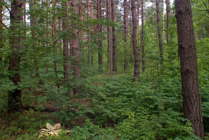 The "Tanaevskaya Dacha" is a man-made forest which has been restored at 1920-1960 on agricultural lands from small pineries of a natural origin by the area about 300 hectares. It is located on the right bank of the Kama River. Within forest besides pineries also are noted areas of larch and small littoral "islets" of white poplar. The grassy cover of coastal zones of southern exposition of Tanaevsky the forest have the elements of steppe formation, here are found Salvia stepposa, Salvia uliginosa, Scorzonera purpurea, Ajuga reptans, Cucubalus baccifer, Deschampsia cespitosa, Koeleria glauca, Echinops ruthenicus, Stipa pennata, Trachonutum sarmatiense (endemic), most of which are listed in the Red Data Book of Tatarstan Republic and the Red Data Book of Russian Federation. The extensive areas of adjacent territory are occupied by cereal-grass upland meadows. The "Maly Bor" is a specially protected area of the national park. The forest is presented by the row of middle-aged pineries and ripening pineries (mixed, with cowberry, bilberry, linden, sedge, fern, green moss, hazel) with participation of linden and oak in an undergrowth, with separate areas of fir-groves (mixed, with bilberry). The southern forest-edge borders on a peatbog and floodplain meadows, where prevail willow and alder. The attendant forest breeds in the Maly Bor are: Betula verrucosa, Fraxinus excelsior, Acer platanoides, Tilia cordata, Populus tremula. The flora of the national park is presented by more than 650 vascular plants species, the base of which is boreal and nemoral plant species, growing in the forest-covered and forest-edged ecotopes; and also plants of upland and floodplain meadows, which confined to watersheds and valley of the Kama River, to valleys of the small rivers.
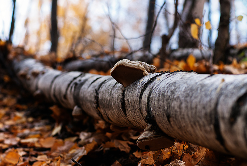
Also at the park grows about 100 species of lichens, more than 50 species of mosses, more than 100 species of fungi Macromycetes (Sparassis crispa, Hericium coralloides are in the Red Data Book of Tatarstan Republic and in the Red Data Book of Russian Federation).
Stipa pennata, Cephalanthera rubra and Neottianthe cucullata which grow in the park are listed in the Red data Book of Russian Federation, 86 plant species which are present in the flora of the national park are included in the Red Data Book of the Tatarstan Republic.
FAUNA
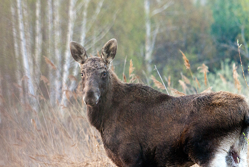
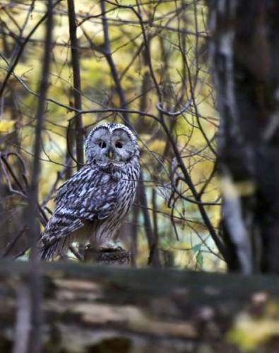 The park Fauna as a whole is typical for the east of middle belt of the European part of Russia. Mammals represented by 46 species. Among them are typical forest inhabitants: elk, roe, wild boar, lynx, badger, marten, squirrel, weasel; as well the water and coastal inhabitants: beaver, musk-rat, otter, racoon-dog. Myotis daubentoni, Plecotus auritus, Pipistrellus nathusii, Sicista betulina, Tamias sibiricus, inhabiting the national park, are rare species and are included to the Red Data Book of Tatarstan. The avifauna is quite diverse (over 200 species, including over 130 breeding species), this is related with the variety of ecotopes.
Most of bird species belong to the forests, to the open spaces and wetlands. The widespread are: Milvus migrans, Accipiter gentilis, Anas platyrhynchos, Ardea cinerea, Dendrocopos major, Scolopax rusticola, Larus ridibundus, Strix aluco, Garrulus glandarius and others. In the spring, during migration in floodplain meadows are marked gray crane, geese, pink flamingo. In winter not a rarity on open spaces a snowy owl. 22 bird species are rare (listed in the Red Data Book of the Tatarstan Republic) - Bubo bubo, Strix aluco, Stix uralensis, Nyctea scandiaca, Haliaeetus albicilla, Falco tinnunculus, Remiz pendulinus, Nucifraga caryocatactes, Larus ichthyaetus and others. Fauna is also presented by: 10 species of amphibians (rare species - Triturus cristatus, Bufo bufo), 6 species of reptiles (rare species - Vipera berus, Coronella austriaca, Anguis fragilis), 28 species of fish (the lake and river species, such as Esox lucius, Sander lucioperca, Stizostedion volgensis, Cyprinus carpio, Acipenser ruthenus, Abramis brama, Lota lota, Silurus glanis, Abramis ballerus, Misgurnus fossilis, Syngnathus nigrolineatus caspius and others). Abundantly are presented invertebrates - more than 1000 species, 53 of which are listed in the Red Data Book of the Tatarstan.
ECOLOGICAL TOURISM
1. The excursion route "Krasnaya Gorka near Elabuga"
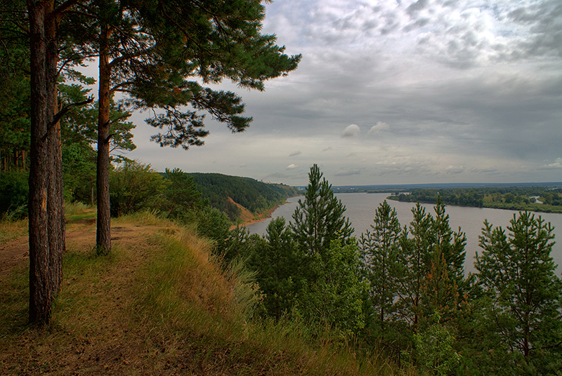 Walks and rest on the Krasnaya Gorka it's age-old tradition of Elabuga's townspeople since the times of merchants. Panoramic view of the valley of the Kama River attracts and the present generation of nature lovers. Around the place of Krasnaya Gorka the high riverbank of the Kama hangs over its river-bed. Huge blocks of limestone and sandy-platy marl enframe the very edge of the cliff. In a fair weather on the horizon are clearly visible the churches belltowers and minarets of mosques of Elabuga, the emerald green silhouette of the Bolshoy Bor, the sinuous riverbed of Kama and reflection of hundreds of floodplain lakes. This place for its beauty and perfection was named the "Krasnaya Gorka". This excursion is remarkable as it passes through the most interesting places from the historic and naturalists' points of view. That is and the purest spring waters of "Lesnaya skazka" ("Forest Fairy Tale") and the famous "Shishkin's" ravine, embodied by the great artist I.I Shishkin in the painting "Kama" (1882), and cosy forest glades, portrayed by the painter in the etching "Taiga" (1880) and on the drawing "Paporotniki" ("Ferns") (1877). The culmination of excursion is the "Krasnaya Gorka" ("Red Hill"), the world-famous place thanks to works by I.I. Shishkin, such as "Red Hill near Elabuga" (1852), the etching "On the Kama River near Elabuga" (1895), the drawing "At the campfire"(1861), the etude "Precipice"(1890). All of basic coast of the Kama River, including the "Krasnaya Gorka", represents scientific interest as a geological monument of nature, because it is basic geological sections of Kazan layer, Tatar layer and Ufa layer of upper Permian sediments that have an international classification value. Here is distinctly traced the alternating of variegated (red with blue lingula's) clays and sandy marls of the Ufa's stage that lies beneath the limestone outcrop in the "Krasnaya Gorka", reflecting the history of sedimentary complexes of the Lower Kama in interrelation with the tectonic movements and the transgression of an ancient sea.
2. The excursion route "Svyatoy Kluch near Elabuga"
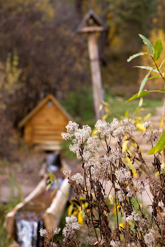 At the times of merchants, when the peal of churches and cathedrals spread far away on the outskirts of Elabuga, around the town was seven sacred healing springs... Since then only the Svyatoy Kluch of the Panteleimon-the-Healer remained unchanged, such it has been embodied by I.I. Shishkin in the painting "Svyatoy Kluch near Elabuga" (1886). This healing source, every year sanctified in a day of St. Panteleimon, is located in a forest the Small Bor, that in several kilometers from the city. The spring is located in a very picturesque and ecologically clean place. Not without reason from time immemorial here the apiary is located. In different periods of I.I.Shishkin's creative work the apiary in the Maly Bor was the motif for creation of some works, including "Paseka" ("The Apiary") (1884), "Beehives in wood" (1884).
The ecological excursion to Maly Bor begins at the Old Chelny road of the Moscow-Kazan branch of the Siberian tract. This road was built under the Decree by empress Catherine II therefore it called the "Ekaterina's". The road on all extent is cobbled by a rubble (a form of natural limestone). Further the ecological road passes through the pine forest. Crossing an old peatbog with numerous lakes, the sightseers appear on a water-meadow. As a whole excursion acquaints visitors as with the historical past of a forest, so with its unique ecosystem, flora and fauna.
3. The excursion route "Bolshoy Bor" (The Big Pine Forest)
 This travel goes on the richest typologically and floristically forest, preserved in the Republic of Tatarstan - the Bolshoy Bor (the Big Pine forest). Situated on the watershed of the Kama River and small river Toima, which is a nature sanctuary, the Bolshoy Bor has many noteworthy places with which tourists get acquainted. Great interest represent a ravines of the Bolshoy Bor: Bogaty, Malinovy, Tulapin, Maly Erhov, Bolshoy Erhov, which are stretching to 2 km deep into the forest. This forest ecosystems are least changed by human activity. Right here a 150-years-old giant pines, a 100-years-old beautiful firs and an ancient lindens are not uncommon. The legend says, what exactly in the Bolshoy Bor Stepan Razin was hiding the treasures... In the area of the village Tarlovka (formerly known as the Black Key) is situated a unique outcrop of an ancient specimens of entomofauna. Along a coastal ledge are found out the limestones with imprints of the ancient flora (Equisetophyta, Pteridophyta) and marine fauna. The greatness of the Bolshoy Bor and the Kama River has found its embodiment in paintings of the landscape painter I.I.Shishkin, such as "The fir forest on the Kama River" (1877), "The wood distances" (1884), and a visiting card of the national park became the picture "The morning at the pine forest" (1884), executed under sketches in the Bogatyi Log tract.
This excursion is especially interesting to experts and amateurs studying plant associations. The trail is laid by different ecotopes and forest area with different typology. It is possible to find many rare and "Red Book" plant species.
4. The excursion route "Forest Lakes"
 This excursion is continuation of studying of a large forest the Bolshoy Bor, its geological features, a plant and animal life. In the northern part of the Bolshoy Bor there is a system of forest shallow lakes belonging to the so-called lakes suffosion type occupying the hollow of blowing with the relative depth of 1,5-7,5 m. Ecosystems of forest lakes represent interesting objects to explore of water and coastal flora. Here grow rare plants such as Comarum palustre, Utricularia vulgaris, Utricularia intermedia, Juncus conglomeratus, Nuphar lutea, Calla palustris, Sparganium minimum, listed in the Red Data Book of the Tatarstan Republic. The lakes are home to muskrats, waterfowl and forest songbirds, on the sunny shores bask grass-snakes and lizards. Elks and roes come here to drink. Amazing forest vegetation near the lakes. Ostrich fern makes a quaint thickets in human growth. The Forest Lake is beautiful at any time of year...
5. The excursion route "Antiquities of the Kama valley"
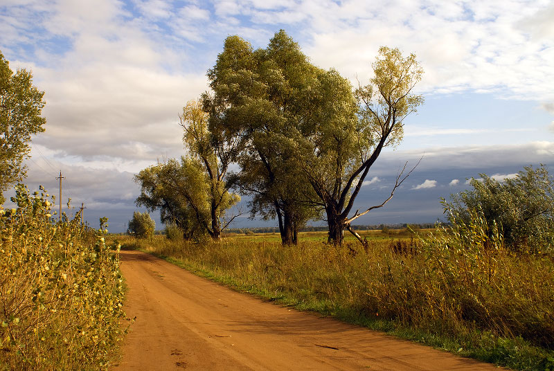 This excursion on places of ancient human sites located within the national park. The route passes through the ancient villages Maltsevo, Lugovoe and the borough of Ananino. Here on the river terraces along the edge of the Bolshoy Bor, archaeologists found sites, settlements and cemeteries. The most ancient sites are dated of the Neolithic epoch. But the greatest fame got excavated near the village of Ananyino concerning to settlements of 6-3 centuries BC. By the name of this place a whole layer of culture is called "Ananyino culture".
In the museum of the famous painter Ivan Ivanovich Shishkin in Elabuga, in the room of head of family - Ivan Vasilyevich Shishkin, a merchant of the second guild, the city mayor, has settled a modest sketch Ananyino burial ground. A meandering road passing past a sandy barrow, two poplars near the road, a horse grazing in meadows, a husbandman in the field, and the Elabuga far on horizon... This etude has documentary value since the artist very exactly has painted an ancient monument of archeology. This place is easily recognizable to this day - the same well-trodden path, the same meadow on the left side, the same horizon line with Elabuga and the hill on the right. In 1858, I.V. Shishkin, together with the clerk of Vyatka regional office P. Alabin conducted the first archaeological excavation of the mound. I.I. Shishkin, in turn, wrote the scetch "View of the Ananyinsky burial ground near Elabuga" (1861), thus documentary embodied this area.
6. The excursion route "Mast-Tree Grove"
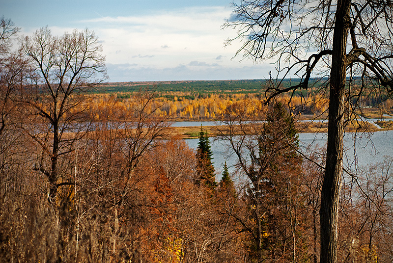 On the left bank of the Kama River, opposite to the Bolshoy Bor, is one of the largest forest of Tatarstan - the Kyzyl-Tausky forest, in the past known as Borovetskaya Mast-Tree Grove. It presents exceptional scientific and historical interest, as it is the extreme south-eastern outpost of the areal of Abies sibirica throughout the Volga region. This forest of natural origin, where spruce and fir form their own unique ecosystem of the middle taiga in the immediate vicinity of the forest-steppe. This forest has secured the former glory of the Kazan Admiralty Ship Grove, founded by Peter I. The proposed route offers to get acquainted with the history of the ship timber on the left bank of the Kama River, to visit the reserve area of taiga with a 130-year old firs, to visit the fountain of St. Paraskeva and the Mill pond, and to walk through the ancient valley of Paleokama.
Tourist routes in the park:
1. "Shishkinsky Krai" (walking route)
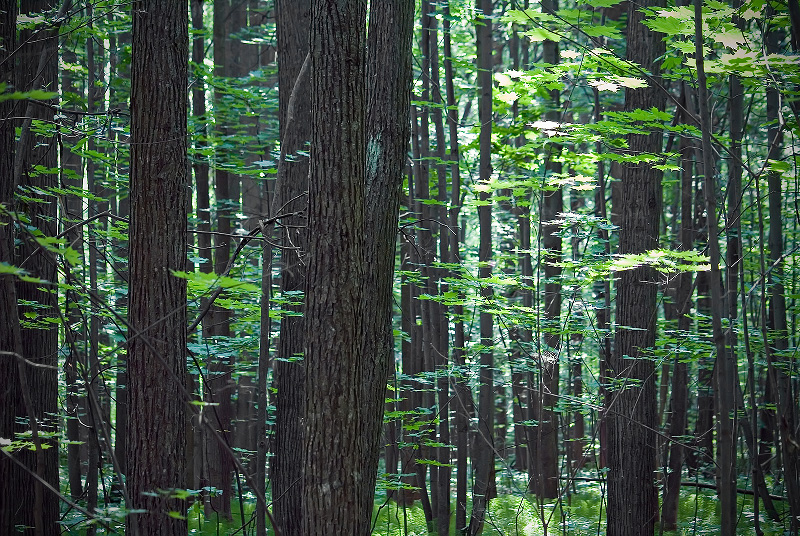 The route goes on a natural complexes and tracts, which served as a motive the famous pieces, I.I. Shishkin - the great Russian landscape painter, who born in the city of Elabuga. Personally you can see the natural sites, captured in pictures "Svyatoi Kluch near Elabuga" (1886),"The Mast-Tree Grove"(1898),"The Landscape with Pine-tree"(1890),"The Forest Gave"(1884),"Pinery","The Pine Forest in the Vyatka province"(1872),"The Morning in a Pine Forest" (1889),"The Ananyinsky Burial Ground" (1861),"The Kama near Elabuga" (1884), etc. Much of the route runs along the scenic places of Bolshoy Bor, Maly Bor and the Tanaevsky forest, as well as within the flood plain meadows in the valley of the river Kama. The route introduces the forests of different typology and origin, including old-growth, with meadow cenosis, oxbow lakes, forest springs, archaeological antiquities of Prikamie. The route length is 65 km. For lodging and meals are provided four bivouac.
2. The water route along the rivers Toima, Kama and Kriusha
 This journey on canoes begins at the downstream Toima, wich is a natural monument of Tatarstan. The lowland river flows among the floodplain meadows, behind which rise a wall of pine forest. The riverbanks are chosen by people thousands of years ago, forming the ancient settlement here. The floodplain abounds with oxbow lakes. On the riverbanks the mighty willows grow. The ancient city appears at the eyes with all of church belltowers and the tower of the ancient settlement of Bulgarskaya epoch. The high right bank reveals slopes with limestones of the ancient Permian Sea. The route passes through the duct Kriusha, crossing Tanaevsky flood meadows, and ends at the steep bank of the Tanaevsky forest. The total length of the water route is 52 km.
The old part of Elabuga is the territory of Historical and Architectural Museum-Reserve. Within the city limits of modern Elabuga known location of settlements Anan'ino, pyanoborskaya and Bulgar era. Familiarity with the city begins with the most ancient and mysterious monument of the past - the Devil's Tower. Walking through the ancient streets, you can learn about the life of a merchants in 19th century's Elabuga. Even today, the city keeps the memory of the famous merchant dynasties Stakheev, Ushkov, Girbasovyh, Chernov. Elabuga among the 30 best-preserved small and medium-sized historical cities of Russia.
Existing museums and expositions in Elabuga:
- House-Museum I.I. Shishkin;
- Museum-Estate N.A. Durova;
- Historical Museum of the City;
- Art gallery;
- Literary museum and memorial M.I. Tsvetaeva.
RESOURCES FOR HUNTERS AND FISHERMEN
In the park hunting is prohibited; allowed amateur fishing for the bait, spinning.
MAP
- by train to the city of Kazan, then by bus to Elabuga (220 km);
- by train to the city Mozhga, then by bus to Elabuga (90 km) or to Naberezhnye Chelny, then to Elabuga;
- by train to Naberezhnye Chelny, then by bus to Elabuga (25 km);
- by plane to the airport "Begishevo", then by bus to Elabuga with change in Naberezhnye Chelny (40 km).
The geographical coordinates of the national Park office for navigators: N55.73031° E51.96403°
Download the driving directions in pdf: http://nkama-park.ru/_ld/0/80_how-to-get_map.pdf
 The National Park "Nizhnyaya Kama" was established in 1991 for preservation and restoration of a unique natural complex of richest floristic and typological forests and floodplain meadow associations of the Tatarstan Republic, and for their use in the scientific, recreational, educational and cultural purposes.
 GEOGRAPHICAL LOCATION
The national park is situated on the north-east of the Tatarstan Republic within the East Predkamje and East Zakamje, in the valley of the Kama River and its inflows of Toima, Kriusha, Tanaika, Shilninka. Administratively territory of park is situated within the two administrative districts - Tukaevsky and Elabuzhsky. The area of national park is 26460 hectares.
CLIMATE
 The climate is temperate-continental, with warm summers and moderately cold winters with the formation of stable snow cover. From local climatic factors it is worth noting structural features of the relief and the presence in the territory of a large body of water - Nizhnekamsk the reservoir. The climate is softened at the expense of western transfer of air masses. The warmest month is July with monthly average air temperature 19,6 degrees Celsius. The coldest month is January with an average temperature - 13.8 degrees Celsius. Period of positive average-monthly temperatures lasts from April till October; from November till March the average-monthly air temperatures negative. Average annual relative humidity - 76%. Annual precipitation - 420-480 mm. About 70% of precipitation falls during the warm season. Prevailing wind directions are westerly, south-west and southern. Average annual wind speed is 3,3-5,0 m/s. The highest wind speeds in winter. Influence of the Nizhnekamsk Reservoir is evident in the increasing wind speed above the water surface and in the coastal zone at the distance of 4-5 km.
 RELIEF
The surface of the territory slightly undulating, partitioned by valleys of small rivers and creeks, gullies and ravines. The general tilting of a surface towards the valley of the Kama River. Ancient and present-day river valleys are confined to areas of tectonic depressions. Watersheds match tectonic structures, characterized by positive neotectonic movements.
 Sculptural features are combined into three genetic categories of relief: denudation, accumulative and erosive-denudation. Denudation relief is presented by the Late Pliocene surface of alignment located on absolute height 180-232 m. Accumulative relief includes into itself the alluvial plains of the left bank of the Nizhnekamsk Reservoir on the absolute elevation of 100-130 m, complicated by dunes and ridges; alluvial plains of the third and fourth floodplain terraces of the Kama River, which are respectively located at the height of 70-90 m and 90-115 m; present-day alluvial plain unites the floodplain terraces of Kama, Toima, Tanaika and Shilna with absolute height of 63-100 m. The erosion-denudation relief widely presented in territory of park, is presented by slopes and occupies absolute heights from 63 to 180 m. High right bank of the Kama River jagged by ravines. The "Tulapin Log", "Maly Erhov" and "Bolshoy Erhov" ravines are going deep into the Bolshoy Bor on 1,5-2 km. Forests of left riverbank of the Kama characterized by a minor manifestations of karst. For the forest "Bolshoy Bor" typical atmogenic forms of relief, formed 7-8 thousand years ago - parabolic dunes, longitudinal dunes, atmogenic hillocks and deflation basins. The precipitous sandy ledges of "Bolshoy Bor", in base of which there are marl layers with remains of ancient flora and fauna, with rare on the territory of Tatarstan Republic pink capitated gypsum, reaching in diameter of 60 sm, possess amazing attraction.
 THE MAIN RIVERS AND LAKES
 The territory of park is divided by the large Kama River, which is currently partitioned off by the hydroelectric power station's dam and has turned into a huge water pool - Nizhnekamsk Reservoir. All of the park's rivers mainly possess mixed food, presented by snowmelt, groundwater and rainwater. On the Kama River and on the small rivers are regular spring floods, which last 30-50 days. Below the dam was preserved the unique floodplain community, where is situated a lot of oxbow lakes, many of which reach a length of 1,5 km. Slightly presented in the park's territory the shallow forest lakes suffosion type, occupying the deflation basins in northern part of the Bolshoy Bor with relative depths 1,5-7,5 m.
 FLORA
The park's location on the border of three climatic subzones (deciduous and fir-deciduous forests, meadow-steppes) has determined a diversity of natural landscape complexes and park's flora.
 The unique Elabuga and Tanaika meadows are represented by floodplain meadows, numerous oxbow lakes, fragments of black poplar woods and well-preserved oakwood around the Boka Lake. The vegetation is represented by several associations: mixed-grass-Poa, Вromus-Sanguisorba, Carex-Poa, Bromus-Poa with Alopecurus, mixed-grass-Festuca.
  Flora of meadows represented by more than 200 plant species. Among them many are in the Red Data Book of Tatarstan Republic - Nymphaea candida (white water-lily), Nuphar luteum (yellow water-lily), Galatella rossica, Gentiana pneumononthe, Valeriana officinalis, Plantago maxima, Salvinia natans (preglacial relic), Potamogeton friesii, Selinum carvifolia, Althaea officinalis, Iris pseudacorus, Lemna gibba, Dianthus pratensis. The floodplain meadows are not withdrawn from economical activity, and therefore, they preserved traditional kinds of activity, such as haymaking, amateur fishing, ecological tourism. Forest cenosises are presented by isolated forests. The most widespread in park are pine forests (compounded with Vaccinium-Oxalis, green-moss, Calamagrostis, Pteridium), spruce-fir and pine-deciduous forests. Deciduous plantations are presented by linden, birch, aspen, black poplar and small oak-woods.
  On the left bank of the Kama River, not farther than 1,5 km from the boundary of Naberezhnye Chelny, located Beloussky the forest, a raisin of which is the tract of fir-forests the Kzyl-Tau. This is the southernmost point of the range of Abies sibirica. Here the spruce and abies form its natural plantations in the immediate vicinity with forest-steppe. A typical feature of this forest is presence in the pinery and its undergrowth of spruce, abies, oak and linden.
  The grassy cover also abounds by the boreal (Linnaea borealis, Pyrola chlorantha, Vaccinium myrtillus, Gymnocarpium dryopteris, Oxalis acetosella) and nemoral (Cacalia hastata, Cicerbita uralensis (endemic), Carex pilosa, Brachypodium sylvaticum, Anemone sylvestris, Platanthera bifolia, Mercurialis annua) plant species.
 The Bolshoy Bor is located on the watershed of Kama and Toima (a right bank of the Kama River). In typological aspect it remains the richest large forest of the Tatarstan Republic. In a vegetative cover of the Bolshoy Bor prevail the pineries with participation of dark-coniferous (Picea fennica, Abies sibirica) and deciduous (Tilia cordata, Quercus robur, Acer platanoides) wood species, with combination in a herb-shrub synfolium of forest-steppe and taiga plant species (Pyrola, Chimaphila umbellata, Neottianthe cucullata, Actаea erythrocarpa, Cotoneaster melanocarpus, Prunus chamaecerasus, Jurinea cyanoides, Circaea alpina, Festuca pseudovina, Festuca valesiaca, Eremogone longifolia).
The "Maly Bor" and the "Tanaevskaya Dacha" are in close proximity from the ancient merchant town of Elabuga.
 The "Tanaevskaya Dacha" is a man-made forest which has been restored at 1920-1960 on agricultural lands from small pineries of a natural origin by the area about 300 hectares. It is located on the right bank of the Kama River. Within forest besides pineries also are noted areas of larch and small littoral "islets" of white poplar. The grassy cover of coastal zones of southern exposition of Tanaevsky the forest have the elements of steppe formation, here are found Salvia stepposa, Salvia uliginosa, Scorzonera purpurea, Ajuga reptans, Cucubalus baccifer, Deschampsia cespitosa, Koeleria glauca, Echinops ruthenicus, Stipa pennata, Trachonutum sarmatiense (endemic), most of which are listed in the Red Data Book of Tatarstan Republic and the Red Data Book of Russian Federation. The extensive areas of adjacent territory are occupied by cereal-grass upland meadows. The "Maly Bor" is a specially protected area of the national park. The forest is presented by the row of middle-aged pineries and ripening pineries (mixed, with cowberry, bilberry, linden, sedge, fern, green moss, hazel) with participation of linden and oak in an undergrowth, with separate areas of fir-groves (mixed, with bilberry). The southern forest-edge borders on a peatbog and floodplain meadows, where prevail willow and alder. The attendant forest breeds in the Maly Bor are: Betula verrucosa, Fraxinus excelsior, Acer platanoides, Tilia cordata, Populus tremula. The flora of the national park is presented by more than 650 vascular plants species, the base of which is boreal and nemoral plant species, growing in the forest-covered and forest-edged ecotopes; and also plants of upland and floodplain meadows, which confined to watersheds and valley of the Kama River, to valleys of the small rivers.
 Also at the park grows about 100 species of lichens, more than 50 species of mosses, more than 100 species of fungi Macromycetes (Sparassis crispa, Hericium coralloides are in the Red Data Book of Tatarstan Republic and in the Red Data Book of Russian Federation).
Stipa pennata, Cephalanthera rubra and Neottianthe cucullata which grow in the park are listed in the Red data Book of Russian Federation, 86 plant species which are present in the flora of the national park are included in the Red Data Book of the Tatarstan Republic.
FAUNA

 The park Fauna as a whole is typical for the east of middle belt of the European part of Russia. Mammals represented by 46 species. Among them are typical forest inhabitants: elk, roe, wild boar, lynx, badger, marten, squirrel, weasel; as well the water and coastal inhabitants: beaver, musk-rat, otter, racoon-dog. Myotis daubentoni, Plecotus auritus, Pipistrellus nathusii, Sicista betulina, Tamias sibiricus, inhabiting the national park, are rare species and are included to the Red Data Book of Tatarstan. The avifauna is quite diverse (over 200 species, including over 130 breeding species), this is related with the variety of ecotopes.
 Most of bird species belong to the forests, to the open spaces and wetlands. The widespread are: Milvus migrans, Accipiter gentilis, Anas platyrhynchos, Ardea cinerea, Dendrocopos major, Scolopax rusticola, Larus ridibundus, Strix aluco, Garrulus glandarius and others. In the spring, during migration in floodplain meadows are marked gray crane, geese, pink flamingo. In winter not a rarity on open spaces a snowy owl. 22 bird species are rare (listed in the Red Data Book of the Tatarstan Republic) - Bubo bubo, Strix aluco, Stix uralensis, Nyctea scandiaca, Haliaeetus albicilla, Falco tinnunculus, Remiz pendulinus, Nucifraga caryocatactes, Larus ichthyaetus and others. Fauna is also presented by: 10 species of amphibians (rare species - Triturus cristatus, Bufo bufo), 6 species of reptiles (rare species - Vipera berus, Coronella austriaca, Anguis fragilis), 28 species of fish (the lake and river species, such as Esox lucius, Sander lucioperca, Stizostedion volgensis, Cyprinus carpio, Acipenser ruthenus, Abramis brama, Lota lota, Silurus glanis, Abramis ballerus, Misgurnus fossilis, Syngnathus nigrolineatus caspius and others). Abundantly are presented invertebrates - more than 1000 species, 53 of which are listed in the Red Data Book of the Tatarstan.
ECOLOGICAL TOURISM
1. The excursion route "Krasnaya Gorka near Elabuga"
 Walks and rest on the Krasnaya Gorka it's age-old tradition of Elabuga's townspeople since the times of merchants. Panoramic view of the valley of the Kama River attracts and the present generation of nature lovers. Around the place of Krasnaya Gorka the high riverbank of the Kama hangs over its river-bed. Huge blocks of limestone and sandy-platy marl enframe the very edge of the cliff. In a fair weather on the horizon are clearly visible the churches belltowers and minarets of mosques of Elabuga, the emerald green silhouette of the Bolshoy Bor, the sinuous riverbed of Kama and reflection of hundreds of floodplain lakes. This place for its beauty and perfection was named the "Krasnaya Gorka". This excursion is remarkable as it passes through the most interesting places from the historic and naturalists' points of view. That is and the purest spring waters of "Lesnaya skazka" ("Forest Fairy Tale") and the famous "Shishkin's" ravine, embodied by the great artist I.I Shishkin in the painting "Kama" (1882), and cosy forest glades, portrayed by the painter in the etching "Taiga" (1880) and on the drawing "Paporotniki" ("Ferns") (1877). The culmination of excursion is the "Krasnaya Gorka" ("Red Hill"), the world-famous place thanks to works by I.I. Shishkin, such as "Red Hill near Elabuga" (1852), the etching "On the Kama River near Elabuga" (1895), the drawing "At the campfire"(1861), the etude "Precipice"(1890). All of basic coast of the Kama River, including the "Krasnaya Gorka", represents scientific interest as a geological monument of nature, because it is basic geological sections of Kazan layer, Tatar layer and Ufa layer of upper Permian sediments that have an international classification value. Here is distinctly traced the alternating of variegated (red with blue lingula's) clays and sandy marls of the Ufa's stage that lies beneath the limestone outcrop in the "Krasnaya Gorka", reflecting the history of sedimentary complexes of the Lower Kama in interrelation with the tectonic movements and the transgression of an ancient sea.
 2. The excursion route "Svyatoy Kluch near Elabuga"
 At the times of merchants, when the peal of churches and cathedrals spread far away on the outskirts of Elabuga, around the town was seven sacred healing springs... Since then only the Svyatoy Kluch of the Panteleimon-the-Healer remained unchanged, such it has been embodied by I.I. Shishkin in the painting "Svyatoy Kluch near Elabuga" (1886). This healing source, every year sanctified in a day of St. Panteleimon, is located in a forest the Small Bor, that in several kilometers from the city. The spring is located in a very picturesque and ecologically clean place. Not without reason from time immemorial here the apiary is located. In different periods of I.I.Shishkin's creative work the apiary in the Maly Bor was the motif for creation of some works, including "Paseka" ("The Apiary") (1884), "Beehives in wood" (1884).
 The ecological excursion to Maly Bor begins at the Old Chelny road of the Moscow-Kazan branch of the Siberian tract. This road was built under the Decree by empress Catherine II therefore it called the "Ekaterina's". The road on all extent is cobbled by a rubble (a form of natural limestone). Further the ecological road passes through the pine forest. Crossing an old peatbog with numerous lakes, the sightseers appear on a water-meadow. As a whole excursion acquaints visitors as with the historical past of a forest, so with its unique ecosystem, flora and fauna.
3. The excursion route "Bolshoy Bor" (The Big Pine Forest)
 This travel goes on the richest typologically and floristically forest, preserved in the Republic of Tatarstan - the Bolshoy Bor (the Big Pine forest). Situated on the watershed of the Kama River and small river Toima, which is a nature sanctuary, the Bolshoy Bor has many noteworthy places with which tourists get acquainted. Great interest represent a ravines of the Bolshoy Bor: Bogaty, Malinovy, Tulapin, Maly Erhov, Bolshoy Erhov, which are stretching to 2 km deep into the forest. This forest ecosystems are least changed by human activity. Right here a 150-years-old giant pines, a 100-years-old beautiful firs and an ancient lindens are not uncommon. The legend says, what exactly in the Bolshoy Bor Stepan Razin was hiding the treasures... In the area of the village Tarlovka (formerly known as the Black Key) is situated a unique outcrop of an ancient specimens of entomofauna. Along a coastal ledge are found out the limestones with imprints of the ancient flora (Equisetophyta, Pteridophyta) and marine fauna. The greatness of the Bolshoy Bor and the Kama River has found its embodiment in paintings of the landscape painter I.I.Shishkin, such as "The fir forest on the Kama River" (1877), "The wood distances" (1884), and a visiting card of the national park became the picture "The morning at the pine forest" (1884), executed under sketches in the Bogatyi Log tract.
 This excursion is especially interesting to experts and amateurs studying plant associations. The trail is laid by different ecotopes and forest area with different typology. It is possible to find many rare and "Red Book" plant species.
4. The excursion route "Forest Lakes"
 This excursion is continuation of studying of a large forest the Bolshoy Bor, its geological features, a plant and animal life. In the northern part of the Bolshoy Bor there is a system of forest shallow lakes belonging to the so-called lakes suffosion type occupying the hollow of blowing with the relative depth of 1,5-7,5 m. Ecosystems of forest lakes represent interesting objects to explore of water and coastal flora. Here grow rare plants such as Comarum palustre, Utricularia vulgaris, Utricularia intermedia, Juncus conglomeratus, Nuphar lutea, Calla palustris, Sparganium minimum, listed in the Red Data Book of the Tatarstan Republic. The lakes are home to muskrats, waterfowl and forest songbirds, on the sunny shores bask grass-snakes and lizards. Elks and roes come here to drink. Amazing forest vegetation near the lakes. Ostrich fern makes a quaint thickets in human growth. The Forest Lake is beautiful at any time of year...
 5. The excursion route "Antiquities of the Kama valley"
 This excursion on places of ancient human sites located within the national park. The route passes through the ancient villages Maltsevo, Lugovoe and the borough of Ananino. Here on the river terraces along the edge of the Bolshoy Bor, archaeologists found sites, settlements and cemeteries. The most ancient sites are dated of the Neolithic epoch. But the greatest fame got excavated near the village of Ananyino concerning to settlements of 6-3 centuries BC. By the name of this place a whole layer of culture is called "Ananyino culture".
 In the museum of the famous painter Ivan Ivanovich Shishkin in Elabuga, in the room of head of family - Ivan Vasilyevich Shishkin, a merchant of the second guild, the city mayor, has settled a modest sketch Ananyino burial ground. A meandering road passing past a sandy barrow, two poplars near the road, a horse grazing in meadows, a husbandman in the field, and the Elabuga far on horizon... This etude has documentary value since the artist very exactly has painted an ancient monument of archeology. This place is easily recognizable to this day - the same well-trodden path, the same meadow on the left side, the same horizon line with Elabuga and the hill on the right. In 1858, I.V. Shishkin, together with the clerk of Vyatka regional office P. Alabin conducted the first archaeological excavation of the mound. I.I. Shishkin, in turn, wrote the scetch "View of the Ananyinsky burial ground near Elabuga" (1861), thus documentary embodied this area.
6. The excursion route "Mast-Tree Grove"
 On the left bank of the Kama River, opposite to the Bolshoy Bor, is one of the largest forest of Tatarstan - the Kyzyl-Tausky forest, in the past known as Borovetskaya Mast-Tree Grove. It presents exceptional scientific and historical interest, as it is the extreme south-eastern outpost of the areal of Abies sibirica throughout the Volga region. This forest of natural origin, where spruce and fir form their own unique ecosystem of the middle taiga in the immediate vicinity of the forest-steppe. This forest has secured the former glory of the Kazan Admiralty Ship Grove, founded by Peter I. The proposed route offers to get acquainted with the history of the ship timber on the left bank of the Kama River, to visit the reserve area of taiga with a 130-year old firs, to visit the fountain of St. Paraskeva and the Mill pond, and to walk through the ancient valley of Paleokama.
 Tourist routes in the park:
1. "Shishkinsky Krai" (walking route)
 The route goes on a natural complexes and tracts, which served as a motive the famous pieces, I.I. Shishkin - the great Russian landscape painter, who born in the city of Elabuga. Personally you can see the natural sites, captured in pictures "Svyatoi Kluch near Elabuga" (1886),"The Mast-Tree Grove"(1898),"The Landscape with Pine-tree"(1890),"The Forest Gave"(1884),"Pinery","The Pine Forest in the Vyatka province"(1872),"The Morning in a Pine Forest" (1889),"The Ananyinsky Burial Ground" (1861),"The Kama near Elabuga" (1884), etc. Much of the route runs along the scenic places of Bolshoy Bor, Maly Bor and the Tanaevsky forest, as well as within the flood plain meadows in the valley of the river Kama. The route introduces the forests of different typology and origin, including old-growth, with meadow cenosis, oxbow lakes, forest springs, archaeological antiquities of Prikamie. The route length is 65 km. For lodging and meals are provided four bivouac.
 2. The water route along the rivers Toima, Kama and Kriusha
 This journey on canoes begins at the downstream Toima, wich is a natural monument of Tatarstan. The lowland river flows among the floodplain meadows, behind which rise a wall of pine forest. The riverbanks are chosen by people thousands of years ago, forming the ancient settlement here. The floodplain abounds with oxbow lakes. On the riverbanks the mighty willows grow. The ancient city appears at the eyes with all of church belltowers and the tower of the ancient settlement of Bulgarskaya epoch. The high right bank reveals slopes with limestones of the ancient Permian Sea. The route passes through the duct Kriusha, crossing Tanaevsky flood meadows, and ends at the steep bank of the Tanaevsky forest. The total length of the water route is 52 km.
 The old part of Elabuga is the territory of Historical and Architectural Museum-Reserve. Within the city limits of modern Elabuga known location of settlements Anan'ino, pyanoborskaya and Bulgar era. Familiarity with the city begins with the most ancient and mysterious monument of the past - the Devil's Tower. Walking through the ancient streets, you can learn about the life of a merchants in 19th century's Elabuga. Even today, the city keeps the memory of the famous merchant dynasties Stakheev, Ushkov, Girbasovyh, Chernov. Elabuga among the 30 best-preserved small and medium-sized historical cities of Russia.
Existing museums and expositions in Elabuga:
- House-Museum I.I. Shishkin;
- Museum-Estate N.A. Durova;
- Historical Museum of the City;
- Art gallery;
- Literary museum and memorial M.I. Tsvetaeva.
RESOURCES FOR HUNTERS AND FISHERMEN
In the park hunting is prohibited; allowed amateur fishing for the bait, spinning.
MAP
- by train to the city of Kazan, then by bus to Elabuga (220 km);
- by train to the city Mozhga, then by bus to Elabuga (90 km) or to Naberezhnye Chelny, then to Elabuga;
- by train to Naberezhnye Chelny, then by bus to Elabuga (25 km);
- by plane to the airport "Begishevo", then by bus to Elabuga with change in Naberezhnye Chelny (40 km).
The geographical coordinates of the national Park office for navigators: N55.73031° E51.96403°
Download the driving directions in pdf: http://nkama-park.ru/_ld/0/80_how-to-get_map.pdf
ACCOMMODATION
- Guest house on a forest cordon within the national park;
- Hotel "ElAZ-Visit," Elabuga, T. Gizzat st., 4, tel. (85557) 5-12-84, fax (85557) 5-12-83;
- Hotel "Toima", Elabuga, Govorova st., 6, tel. (85557) 4-14-73;
- Sanatorium "Cosmos" NGDU "Prikamneft", Tanaevsky forest (the National Park), 7 km from Elabuga, tel. (85557) 2-75-20, 2-77-68, 2-73-89.
SERVICES PROVIDED BY THE PARK
In the park there are about 200 resorts and dispensaries. Information can be obtained at the central office of the park.
CONTACT INFORMATION
Location: The Republic of Tatarstan, 423603, Elabuzhsky area, Tanaevsky Forest st. 109
Tel. +7 (85557) 2-70-18;
Fax +7 (85557) 2-71-52;
Department of environmental education: 8 (85557) 2-71-42;
nkama@mail.ru, ecopros-nk@yandex.ru
Elabuga Historical and Architectural Museum Reserve was established in 1990. It includes 225 monuments of architecture. The museum consists of an ensemble of urban Elabuga late 18th - early 20th century, the House-Museum I.I. Shishkin, the Museum-Estate N.A. Durova, Marina Tsvetaeva Museum, the Museum of Elabuga, Elabuzhskoe Gorodishe, Ananyinsky burial ground.
Elabuzhskoe Gorodishe ("Devil's Tower") - the historical and archaeological monument of nature. Located on a high steep bank of the Kama River. Here is the only surviving stone tower of the Bulgar 10-16 cc. It is a symbol of the city Elabuga.
Museum-Estate N.A. Durova, opened in the estate house, where Nadezhda Andreyevna has spent the last 25 years of life. N. Durova - Russia's first female officer, writer, known as "trooper-girl".
House-museum of the artist, I.I. Shishkin - Russia's only museum dedicated to landscape painter I.I. Shishkin (1832-1898). Provincial merchant's mansion first half of the 19th century. The museum has the original canvases. It has an aesthetic and historical significance.
Ananyinsky burial ground, the monument of Anan'ino culture. Tentatively dated to 3-4 century BC. Oe. Located in the floodplain meadows, near the village Maltsevo Elabuga district. Burial ground, with a special kind of rite of burial, including the cult of fire. In some graves were found round-ceramic vessels, bronze knives, daggers, arrowheads and spears, jewelry.
The natural monument of Tatarstan, river Toima - tributary of the Kama River. The source of the river in Udmurtia. The river lenth is 124 km, the width varies from 5 m to 40 m, depth - 0.5 - 2.0 m. The river has the economic and environmental value.
Starting materials were developed by: deputy. Director of Science Y.A. Lukyanova, head. Museum of Nature R. Bekmansurov. Photo by D. Zhukov


